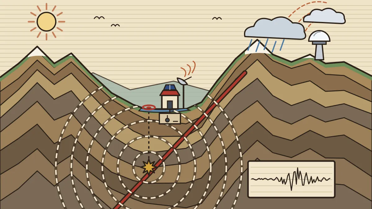
On 2 November 2026, Dr Jitendra Singh, Union Minister of State (Independent Charge) for Science & Technology and Earth Sciences, inaugurated a new Seismological Observatory at Kishtwar, in the high-hazard Himalayan belt of Jammu and Kashmir. The observatory belongs to the Ministry of Earth Sciences. Its digital instruments send readings in real time to the 24x7 Earthquake Monitoring Centre of the National Centre for Seismology (NCS) in New Delhi. With it, Jammu and Kashmir now has four seismological observatories: Jammu, Srinagar, Udhampur and Kishtwar.
The same event was used to list how the region's weather-watching network has grown since 2014: Doppler radars, automatic weather stations, rain gauges and panchayat-level forecasts. Put together, the announcement shows how one mountain district is being wired to listen to the ground and watch the sky. This article explains both halves in the way the NDA paper tends to ask about them: the geography of why the area is dangerous, the physics of how a seismograph works, and the names, numbers and places a candidate should know.
The announcement in numbers
The release gives several before-and-after figures. They are worth reading in a table, because examiners lift exactly this kind of figure.
| Item | Earlier | Now |
|---|---|---|
| Seismological observatories in J&K | Jammu, Srinagar, Udhampur | 4, with Kishtwar added |
| Doppler Weather Radars in J&K | None in 2014 | 4 installed in 12 years (Banihal, Jot, Jammu, Srinagar) |
| More radars planned | 4 in 2027 (Doda, Kishtwar, Anantnag, Baramulla), making 8 | |
| Automatic Weather Stations | 3 (Udhampur, Kathua, Ramban) | 12 (4 in Kishtwar, 2 each in Doda and Ramban, 1 more in Kathua) |
| Rain gauge stations (five districts) | 9 | 15 |
Beyond the table, the Minister mentioned panchayat-level weather forecasts across the five districts of his constituency, agromet advisories that have reached 5,467 beneficiaries, a High-Altitude Cloud Physics Laboratory at Patnitop, and a Regional Meteorological Centre at Jammu for weather and early warning services. He linked the expansion to the Chasoti cloudburst of last year and added that "administrative boundaries may change, but geographical challenges remain".
Why the ground here is restless
Kishtwar lies in the Chenab valley, where the Pir Panjal range and the Great Himalaya meet, close to the Zanskar mountains. It sits on one of the most active collision zones on Earth.
- The collision. The Indian plate is moving north into the Eurasian plate at roughly 4 to 5 cm a year. The two continental plates are too light to sink easily, so the crust crumples upward. This crumpling built the Himalaya and is still going on. Our notes on plate tectonics and the Earth's interior cover the mechanism.
- The thrust faults. The squeezing is taken up along great thrust faults that run along the range: the Main Frontal Thrust, the Main Boundary Thrust and the Main Central Thrust. Beneath them lies the Main Himalayan Thrust, the master fault on which the Indian plate slides under the mountains. Strain builds up along these faults for decades or centuries, and an earthquake is the sudden release.
- A local detail. Near Kishtwar, geologists have mapped a tectonic window, a place where erosion has cut through an upper thrust sheet and exposed older rocks beneath it. Here the Lesser Himalayan rocks show through the Higher Himalayan sheet, and the local name for the Main Central Thrust is the Kishtwar Thrust. Studies suggest this block is still being pushed up, at around 3 mm a year, a sign of active deformation.
India's building code divides the country into seismic zones by hazard. Under the long-standing scheme (IS 1893), there are four: Zone II (lowest) to Zone V (highest). Roughly 11% of India's area lies in Zone V, 18% in Zone IV and 30% in Zone III, so about 59% of the land is exposed to moderate or severe shaking. Zone V covers the Kashmir valley, most of the north-east, the Rann of Kachchh and the Andaman and Nicobar Islands, and much of Jammu and Kashmir lies in Zones IV and V. The zone map tells builders how strong a structure must be; it does not predict when a quake will come.
How an observatory finds an earthquake
A seismological observatory is built around a seismometer, an instrument whose heavy mass stays nearly still while the ground moves under it. The relative motion is converted to an electrical signal, recorded digitally as a seismogram, and, in modern stations such as the one at Kishtwar, streamed to the monitoring centre.
An earthquake sends out different kinds of waves:
- P waves (primary): compressional, the fastest, and able to travel through solids and liquids.
- S waves (secondary): shear waves, slower, and unable to pass through liquids. Their failure to cross the outer core is how seismologists discovered that part of the Earth is liquid.
- Surface waves (Love and Rayleigh): the slowest, but they travel along the ground and cause most of the damage.
The point where the rock breaks is the focus (hypocentre); the point on the surface directly above it is the epicentre. Because P waves arrive before S waves, the time gap between them at one station gives the distance to the focus. A single station gives only a circle of possible positions, so the epicentre is fixed by combining at least three stations. That is why a dense network matters: more stations mean more accurate locations, faster alerts and the ability to detect small tremors.
Two terms are often mixed up:
- Magnitude measures the energy released at the source and has one value per earthquake. It is on a logarithmic scale: each step up is about 10 times the shaking amplitude and roughly 32 times the energy.
- Intensity describes the effects at a particular place, using a scale such as the Modified Mercalli scale (I to XII). It is higher near the epicentre and on soft ground, and it varies from place to place for the same earthquake.
The NCS is the Government of India's nodal agency for monitoring earthquakes. It runs the National Seismological Network, which was reported to have 152 observatories in 2023 parliamentary replies; the NCS website now cites more than 170 stations. All of them send data to the control room in New Delhi by satellite link or mobile data connection.
A short ledger of Indian earthquakes
These events recur in general-knowledge questions. Magnitudes are approximate and differ slightly between agencies.
| Year | Place | Magnitude | Why it is remembered |
|---|---|---|---|
| 1905 | Kangra, Himachal Pradesh | about 7.8 | Himalayan thrust earthquake; about 20,000 deaths |
| 1950 | Assam-Tibet | about 8.6 | Eastern Himalaya; Brahmaputra basin |
| 1993 | Latur, Maharashtra | about 6.2 | Shallow quake in peninsular India, far from any plate boundary |
| 2001 | Bhuj, Gujarat | about 7.7 | Struck on 26 January; heavy toll in Kachchh |
| 2005 | Kashmir | about 7.6 | 8 October; most of the deaths were across the Line of Control |
| 2015 | Nepal (Gorkha) | about 7.8 | 25 April; felt across north India |
Latur is the question writers' favourite: it shows that peninsular India, long thought stable, is not free from risk. A related idea is reservoir-induced seismicity, in which the weight and seepage of water behind a large dam alter stresses in the rock. The Koyna earthquake of December 1967, with a magnitude above 6, is the standard Indian example.
The sky side: radars, stations and gauges
The Minister's weather figures matter because mountain rainfall is local. A storm cell over one valley may drop heavy rain while the next valley stays dry, and hills block the beam of a distant radar. Three kinds of instrument fill the gap:
- Doppler Weather Radar. It sends out microwaves and measures the shift in frequency of the echo from raindrops, which shows both where the rain is and how fast it is moving. Our explainer on India's growing radar network describes the physics and the radar bands.
- Automatic Weather Stations (AWS). Self-contained sensor posts that measure temperature, humidity, pressure, wind and rainfall and send readings automatically, without a person on site.
- Rain gauges. The simplest tool and the ground truth that checks the radar's estimates.
The release ties part of the expansion to the Chasoti cloudburst of 14 August 2025, which hit near the Machail Mata pilgrimage route in Kishtwar and caused heavy loss of life; later reports put the death toll above 60. A cloudburst is an extreme burst of rain over a very small area in a short time. It is hard to forecast and is deadliest in steep valleys. Our piece on cloudbursts in the Himalaya explains the mechanism. The Minister's closing point was practical: warnings save lives only when people act on them, and he cited traffic being restricted after a weather alert, with later damage to the highway showing why the alert mattered.
A power hub on a young mountain
The Minister also called Kishtwar a major power hub. The district already hosts the Dul Hasti station (390 MW, commissioned 2007) on the Chenab, and several large projects are under construction or nearing completion, including Pakal Dul (1,000 MW, on the Marusudar, a Chenab tributary), Kiru (624 MW), Kwar (540 MW) and Ratle (850 MW). Large dams in a seismic region need good data for three reasons: engineers use hazard studies to set design standards, operators need quick warnings of shaking, and monitoring helps spot any quakes linked to filling reservoirs. The new observatory therefore serves safety, planning and infrastructure at once. For the river system itself, see our notes on Indian physiography and drainage.
What the release does not say
The release is a ministerial speech, not a technical bulletin. It gives no instrument type, magnitude threshold for alerts or cost, and it does not give the exact seismic zone of Kishtwar. The four additional radars are described as due in 2027; the release gives no site-wise dates. Treat any option that adds a technical detail to the Kishtwar observatory as unsupported.
🔑 Revision block
The event. 2 November 2026: Dr Jitendra Singh inaugurated the Seismological Observatory at Kishtwar (Ministry of Earth Sciences); data goes in real time to the NCS 24x7 centre, New Delhi. J&K now has 4: Jammu, Srinagar, Udhampur, Kishtwar.
The weather numbers. Doppler radars 0 (2014) → 4, 4 more in 2027 (Doda, Kishtwar, Anantnag, Baramulla) = 8. AWS 3 → 12. Rain gauges 9 → 15. Also: panchayat-level forecasts, 5,467 agromet beneficiaries, Patnitop cloud-physics laboratory, Jammu Regional Meteorological Centre.
The geography. Indian plate moving north about 4 to 5 cm a year; Himalayan thrusts MFT, MBT, MCT over the Main Himalayan Thrust; Kishtwar has a tectonic window (local MCT = Kishtwar Thrust).
The physics. P (fast, solids and liquids), S (slower, not through liquids), surface waves (damaging). S minus P time gives distance; 3 stations fix the epicentre. Magnitude = source energy (one value; +1 ≈ 10× amplitude, ≈ 32× energy); intensity = local effects (varies by place).
The zones. IS 1893: Zone II to V; about 59% of India's area in Zones III to V.
The cloudburst. Chasoti, 14 August 2025, route to Machail Mata; over 60 deaths reported.
🎯 Practice MCQs
Q1. Which body is the Government of India's nodal agency for monitoring earthquakes and runs the 24x7 monitoring centre in New Delhi?
(a) India Meteorological Department
(b) Geological Survey of India
(c) National Centre for Seismology
(d) National Disaster Management Authority
→ (c)
The NCS, under the Ministry of Earth Sciences, runs the National Seismological Network and the monitoring centre. The IMD handles weather, the GSI geological mapping and the NDMA disaster-response policy.
Q2. How many Doppler Weather Radars did Jammu and Kashmir have in 2014, according to the 2 November 2026 release?
(a) None
(b) 2
(c) 4
(d) 8
→ (a)
The Minister said there was not a single Doppler Weather Radar in 2014. Four have been installed since and four more are due in 2027, making eight.
Q3. The number of Automatic Weather Stations in the region rose from 3 to:
(a) 6
(b) 9
(c) 10
(d) 12
→ (d)
Nine stations were added, including four in Kishtwar, two each in Doda and Ramban and one in Kathua, giving 12.
Q4. Which seismic waves cannot travel through liquids?
(a) Primary (P) waves
(b) Secondary (S) waves
(c) Rayleigh waves
(d) Both P waves and S waves
→ (b)
S waves are shear waves and a liquid cannot support shear. That is why they do not cross the Earth's liquid outer core. P waves pass through solids and liquids alike.
Q5. Consider the following statements:
1. Each increase of one unit in earthquake magnitude corresponds to about 10 times the energy released.
2. The intensity of an earthquake is measured by its effects at a location and varies from place to place.
Which of the statements given above is/are correct?
(a) 1 only
(b) 2 only
(c) Both 1 and 2
(d) Neither 1 nor 2
→ (b)
One unit of magnitude means about 10 times the amplitude but roughly 32 times the energy, so statement 1 is wrong. Statement 2 correctly describes intensity.
Q6. The 1905 earthquake that killed about 20,000 people in the Himalayan foothills struck at:
(a) Bhuj
(b) Latur
(c) Uttarkashi
(d) Kangra
→ (d)
The 1905 Kangra earthquake in Himachal Pradesh was a Himalayan thrust event. Bhuj was struck in 2001 and Latur in 1993.
Q7. Kishtwar district lies in the valley of which river?
(a) Chenab
(b) Jhelum
(c) Ravi
(d) Beas
→ (a)
Kishtwar is in the Chenab valley, and the Marusudar, site of the Pakal Dul project, is a tributary of the Chenab.
Q8. The Chasoti cloudburst of August 2025 occurred on the route to which shrine?
(a) Vaishno Devi
(b) Amarnath
(c) Machail Mata
(d) Kheer Bhawani
→ (c)
Chasoti is the last motorable point before the Machail Mata shrine in Kishtwar, and the yatra was suspended after the cloudburst.
📋 How this gets asked (PYQ pattern)
Earth-science questions in the NDA paper come in three shapes. The first is concept: which wave cannot cross a liquid, the difference between focus and epicentre, magnitude versus intensity. These are settled by the textbook facts above. The second is place and event: which earthquake struck which state, and which region falls in the highest seismic zone. The third is the news fact: an institution, a number or a place from the latest release.
Wrong options tend to swap close neighbours: the NCS with the IMD or the GSI, S waves with P waves, magnitude with intensity. The fresh hooks this cycle are Kishtwar, four observatories in J&K, 0 to 4 radars with 4 more in 2027, 3 to 12 automatic weather stations and the Chasoti cloudburst.
Preparing for NDA? Draw one sketch of an earthquake with focus, epicentre and the three wave types, and keep a six-line table of India's major earthquakes. Our NDA study material builds the geography and physics behind these stories, the daily NDA current affairs keeps the list current, and the upcoming Cavalier courses in Delhi prepare you for the written paper and the SSB.
Source: PIB (Ministry of Earth Sciences), "Dr Jitendra Singh highlights expansion of disaster preparedness and weather monitoring infrastructure with new Seismological Observatory inaugurated in high seismic region of Kishtwar", 2 November 2026 (Release ID 2331574). Background cross-checked with the National Centre for Seismology and parliamentary replies on the National Seismological Network, news reports on the Chasoti cloudburst (14 August 2025), published geological studies of the Kishtwar Window, and NCERT-level material on seismic zones and earthquake history; hydropower capacities from NHPC and Central Electricity Authority material. Magnitudes of past earthquakes are approximate and vary slightly between agencies.
✍️ Written by Col D.N. Sharma — Science & general-studies faculty at The Cavalier. Reviewed by the Cavalier Faculty Desk.