Maps were once a matter of national security, guarded and slow to change. They are now treated as an economic resource. On 30 October 2026, the Survey of India organised a workshop in New Delhi titled "Government & Industry Synergy for Geospatial Transformation: Co-Creating the Geospatial Economy for Viksit Bharat 2047". Its message was that location data should be produced, shared and used as widely as possible.
Union Minister Dr Jitendra Singh called geospatial capability "a key determinant" of India's future economic growth. He summed up the government's approach in three words: "enable, invest and adopt". He asked ministries to work with the Survey of India on applications, and asked the Surveyor General to brief them on the organisation's capabilities. He said the National Geospatial Policy 2022 provides an open framework that can absorb new technologies, including geospatial artificial intelligence.
The workshop was attended by the Surveyor General, S.K. Sinha; the chairman of the Geospatial Data Promotion and Development Committee (GDPDC), Srikant Sastri; and the Secretary of the Department of Science and Technology (DST). This article explains what geospatial data is, how India's mapping policy changed, and what the 2022 policy aims to achieve.
What "geospatial" means
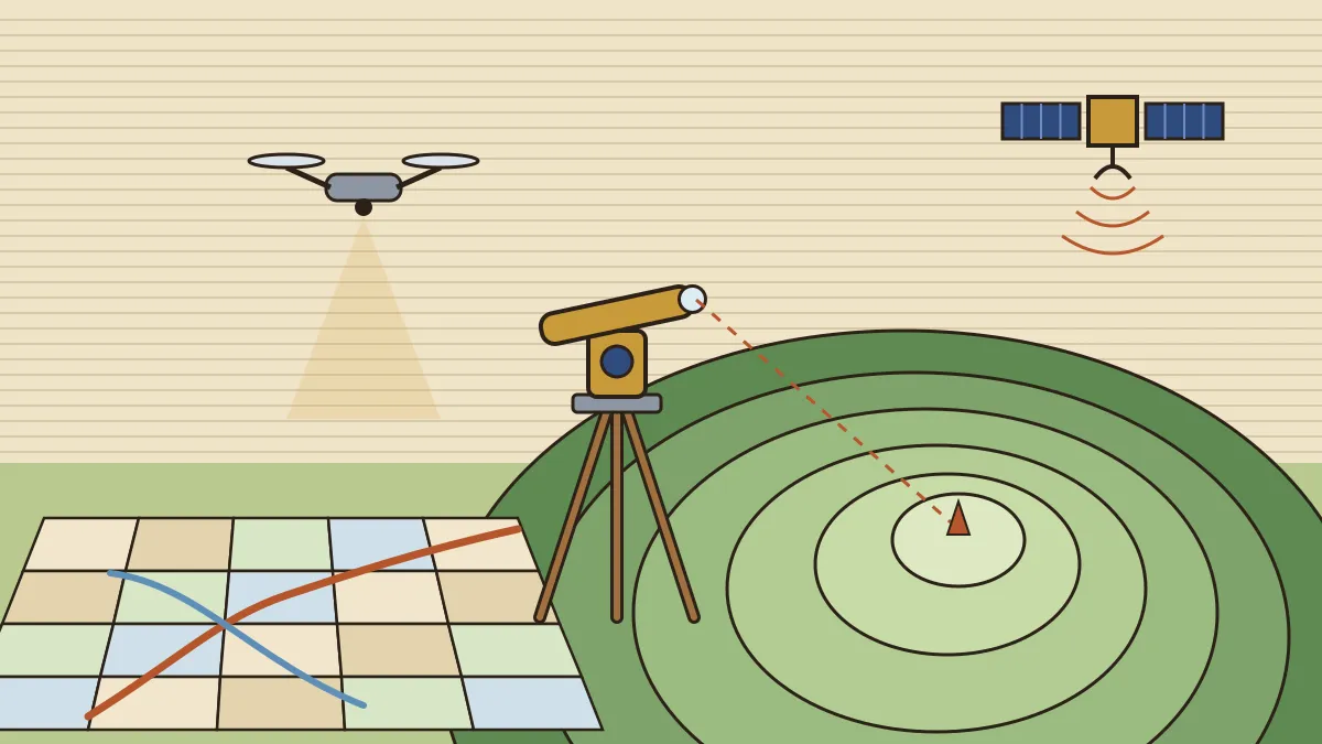
Geospatial data is any information tied to a location on Earth. It includes: - maps and topographic sheets; - satellite and aerial imagery, including drone images; - positions from navigation satellites such as GPS and India's NavIC; - elevation data such as Digital Elevation Models (DEMs), often collected by LiDAR (laser scanning); - any dataset with coordinates attached, from land parcels and roads to power lines and disease cases.
A Geographic Information System (GIS) is the software that stores and layers such data, so that an analyst can, for example, place flood-prone areas on top of village boundaries and hospitals. The precision of the location fix is what makes the data valuable. That precision depends on navigation satellites and on ground reference stations, which is why the NavIC system is part of the same story.
The Survey of India: 259 years of mapping
The Survey of India was set up in 1767, under the East India Company, to map the territories it controlled. It is India's oldest scientific department and its national survey and mapping organisation, headed by the Surveyor General of India, with headquarters in Dehradun. Today it works under the Department of Science and Technology.
Its most famous project was the Great Trigonometrical Survey (GTS): - It began in 1802 under William Lambton, near Madras, and measured the land through chains of triangles. - Its spine, the "Great Arc", ran north from the southern tip of India along roughly the 78°E meridian towards the Himalaya. It was one of the longest arcs of a meridian measured anywhere at the time. - George Everest continued the work and served as Surveyor General from 1830 to 1843. - From GTS observations, Peak XV was computed in 1852 to be the world's highest mountain. It was named Mount Everest in 1865, after the former Surveyor General, although he had played no part in measuring it.
The minister noted that the Survey of India has moved from labour-intensive field surveying to satellite-based mapping, drones and computer processing. Its online map portal now offers its data openly, and it runs a network of Continuously Operating Reference Stations (CORS) that correct satellite positions to centimetre-level accuracy.
From restriction to liberalisation (2021)
For decades, collecting and publishing maps in India required permissions, and the National Map Policy of 2005 kept tight controls. Private firms that wanted to survey land, fly drones or build digital maps faced licences and security vetting.
That changed on 15 February 2021. The government issued liberalised guidelines for geospatial data, which: - removed the need for prior approval, security clearance or licences for Indian entities to collect, store and publish geospatial data, with a short negative list for sensitive locations; - required that geospatial data produced with public funds (except classified data of security agencies) be made easily accessible to all Indian entities; - reserved some of the finest-resolution mapping for Indian entities.
The government said at the time that the reform would help build a ₹1 lakh crore geospatial economy. It came after the opening of the space sector in 2020 and was followed by the drone rules of 2021, a "troika" of reforms that the minister often mentions together.
The National Geospatial Policy 2022
The guidelines were turned into a full policy in December 2022. The National Geospatial Policy (NGP) 2022:
- names the Department of Science and Technology as the nodal agency for the geospatial sector;
- creates the Geospatial Data Promotion and Development Committee (GDPDC) as the apex body. It takes over the work of the National Spatial Data Committee (set up in 2006) and of the GDPDC formed in 2021;
- replaces the National Map Policy, 2005;
- plans a National Geospatial Data Registry (NGDR) and a Unified Geospatial Interface (UGI), a single online service through which users can query and use data from central and state agencies.
Its targets are set in three steps:
| By | Target |
|---|---|
| 2025 | An enabling policy and legal framework that supports the liberalisation of the sector |
| 2030 | High-resolution topographical survey and mapping at 5–10 cm for urban and rural areas and 50–100 cm for forests and wastelands; a high-accuracy Digital Elevation Model for the country |
| 2035 | Digital twins of major cities: live, data-driven virtual copies used for planning |
The National Geospatial Mission
The Union Budget 2025-26 announced a National Geospatial Mission to build the foundations those targets need. According to the government's replies in Parliament: - it will use PM Gati Shakti to support the modernisation of land records, urban planning and infrastructure design, with an initial outlay of ₹100 crore; - its components are a stronger National Geodetic Reference Frame, mapping infrastructure, Geo-ICT infrastructure, training and technology development; - India's countrywide DEM is currently available at 10 m resolution. The mission envisages 25 cm for plains and all urban areas and 1–3 m for hilly and mountainous regions.
In March 2026 the government told Parliament that the mission's Cabinet note was being finalised after stakeholder consultation.
Where geospatial data is already at work
- SVAMITVA (launched on 24 April 2020, National Panchayati Raj Day) uses drones to map inhabited rural land and issue property cards to households. Owners can then use their homes as collateral for loans. The panchayat link is covered in our notes on local governance.
- PM Gati Shakti National Master Plan (launched in October 2021) layers data on roads, railways, pipelines, forests and settlements on a single GIS platform, so that infrastructure projects can be planned across ministries.
- Land records: the Unique Land Parcel Identification Number (ULPIN), a 14-digit ID called "Bhu-Aadhaar", is generated from the geo-coordinates of each plot.
- Disaster management, agriculture and defence all use the same data, from flood maps and crop estimates to terrain models for military planning.
Why it matters for the exam and beyond
Mapping questions in the CDS and NDA have traditionally been about topographic sheets, scales, contours and the history of the Survey of India. The policy story adds a modern layer: who regulates geospatial data, what was liberalised and when, and how drones, satellites and AI now share one field. The cartography basics (scale, contours, projections) are on our page on isolines, maps and projections.
🔑 Revision block
The news. Survey of India workshop, 30 October 2026: "Government & Industry Synergy for Geospatial Transformation"; Dr Jitendra Singh: "enable, invest and adopt". Surveyor General S.K. Sinha; GDPDC chairman Srikant Sastri.
Survey of India. Set up 1767; oldest scientific department; HQ Dehradun; under DST; head = Surveyor General. GTS from 1802 (William Lambton); George Everest Surveyor General 1830–43; Peak XV computed highest 1852, named Everest 1865.
Liberalisation. Guidelines of 15 February 2021: no prior approval or licence for Indian entities; publicly funded data open (except classified).
NGP 2022. Notified December 2022; DST nodal; GDPDC apex (subsumes NSDC of 2006); replaces National Map Policy 2005; NGDR + UGI. Targets: 2025 legal framework; 2030 5–10 cm mapping and high-accuracy DEM; 2035 digital twins of major cities.
National Geospatial Mission. Budget 2025-26; uses PM Gati Shakti; initial ₹100 crore; DEM 10 m now → 25 cm plains, 1–3 m hills.
Applications. SVAMITVA (24 April 2020, drone property cards); Gati Shakti (October 2021); ULPIN = 14-digit "Bhu-Aadhaar"; CORS for centimetre-level positioning.
🎯 Practice MCQs
Q1. The Survey of India was established in: (a) 1767 (b) 1802 (c) 1857 (d) 1905
→ (a) 1802 is when the Great Trigonometrical Survey began; the Survey itself dates to 1767.
Q2. The Great Trigonometrical Survey of India was begun by: (a) George Everest (b) James Rennell (c) Radhanath Sikdar (d) William Lambton
→ (d) Lambton began it in 1802. Everest continued it and became Surveyor General; Rennell was the first Surveyor General of Bengal; Sikdar was the computer whose calculations identified Peak XV.
Q3. Under the National Geospatial Policy 2022, the apex body for the geospatial sector is the: (a) National Remote Sensing Centre (b) Geospatial Data Promotion and Development Committee (c) Indian National Space Promotion and Authorisation Centre (d) National Spatial Data Committee
→ (b) The GDPDC is the apex body and takes over the role of the National Spatial Data Committee (2006). IN-SPACe regulates private space activity.
Q4. Which policy did the National Geospatial Policy 2022 replace? (a) Remote Sensing Data Policy, 2001 (b) National Data Sharing and Accessibility Policy, 2012 (c) Drone Rules, 2021 (d) National Map Policy, 2005
→ (d) The 2005 map policy kept tight controls; the 2022 policy replaced it.
Q5. Consider the following statements about the guidelines on geospatial data issued in February 2021: 1. Indian entities no longer need prior approval to collect and publish most geospatial data. 2. Geospatial data produced with public funds, except classified data, is to be made easily accessible to Indian entities. Which of the statements given above is/are correct? (a) 1 only (b) 2 only (c) Both 1 and 2 (d) Neither 1 nor 2
→ (c) Both describe the 2021 liberalisation, which the 2022 policy built on.
Q6. The SVAMITVA scheme uses drone surveys mainly to: (a) Issue property cards for inhabited rural land (b) Map forest cover for carbon credits (c) Survey national highways for tolling (d) Monitor crop insurance claims
→ (a) It maps village abadi (inhabited) areas and gives households a record of rights they can use as collateral.
Q7. Under the National Geospatial Policy 2022, digital twins of major cities are targeted by: (a) 2025 (b) 2030 (c) 2035 (d) 2047
→ (c) 2025 is the legal framework, 2030 high-resolution mapping and a DEM, and 2035 the digital twins.
Q8. The 14-digit Unique Land Parcel Identification Number (ULPIN) is popularly called: (a) Bhu-Naksha (b) Bhu-Aadhaar (c) Bhuvan (d) Gram Manchitra
→ (b) ULPIN, or Bhu-Aadhaar, is generated from a plot's geo-coordinates. Bhuvan is ISRO's geoportal and Gram Manchitra a panchayat planning app.
📋 How this gets asked (PYQ pattern)
The CDS and NDA geography papers test mapping in two layers.
The first is classic cartography: what a topographic sheet shows, map scales, contour patterns, and the history of surveying, with the Survey of India, the Great Trigonometrical Survey and Mount Everest as recurring names. "Who began the GTS?" and "when was the Survey of India set up?" are favourites.
The second is technology and policy: remote sensing, GIS, GNSS (GPS/NavIC) and India's mapping rules. Policy questions here tend to be statement-based, asking what a reform allowed or which body leads it. The fresh hooks this cycle are the NGP 2022 targets (2025/2030/2035), DST as nodal agency, the GDPDC, the National Geospatial Mission and the "enable, invest and adopt" message of the 30 October workshop.
Preparing for CDS? Pair every technology story with its geography basics: here, contours, scales and the history of the Survey of India. Our CDS/OTA geography notes cover the basics, the daily CDS current affairs the news, and the upcoming Cavalier courses in Delhi bring the two together with regular tests.
Source: PIB / Ministry of Science & Technology, "Geospatial capabilities will be a key determinant of India's future economic growth: Dr. Jitendra Singh", 30 October 2026; Ministry of Science & Technology, "Government announces liberalised guidelines for geo-spatial data" (15 February 2021); Parliament replies on the National Geospatial Mission (10 December 2025 and 12 March 2026). National Geospatial Policy 2022 targets and history of the Survey of India cross-checked with DST material and standard references.
✍️ Written by Col D.N. Sharma — Science & general-studies faculty at The Cavalier. Reviewed by the Cavalier Faculty Desk.